GeoSphere Austria provides weather forecasts around the clock. Warnings are issued in the event of extreme weather. These warnings refer to the expected effects and possible dangers rather than only on the weather itself.
What the weather will be like is relevant for many people and industries. Weather forecasts help to prepare for the upcoming meterological conditions. The forecasts not only help in deciding whether it is necessary to, e.g., bring an umbrella today. Rather, they serve as an important planning criterion for many sectors and play an essential role in counteracting any dangers well in advance. GeoSphere Austria provides forecasts around the clock and also issues warnings in the event of extreme weather.
Our weather forecasts and weather warnings are freely available online:
Weather forecasts as a basis for planning and
preparation
Even in the private sphere, weather forecasts can play a role in planning and decision-making: ‘Can this weekends’ party be held outdoor?’ or ‘Will the weather be suitable for a hike in the mountains?’
The same is true for many professional sectors and industries, and weather forecasts play a role in planning here as well. Information about the upcoming weather is used in agriculture, for example, where detailed precipitation forecasts are relevant for planning the hay harvest or irrigation management, among other things. Weather forecasts are also important for organisers of major events. At open-air events in the summer months, for example, it is not just a question of forecasting precipitation, but also of estimating the risk of thunderstorms. In contrast, knowledge of the expected snow and black ice conditions is essential for planning winter service operations. GeoSphere Austria offers specialised forecasting and consulting services for many areas.
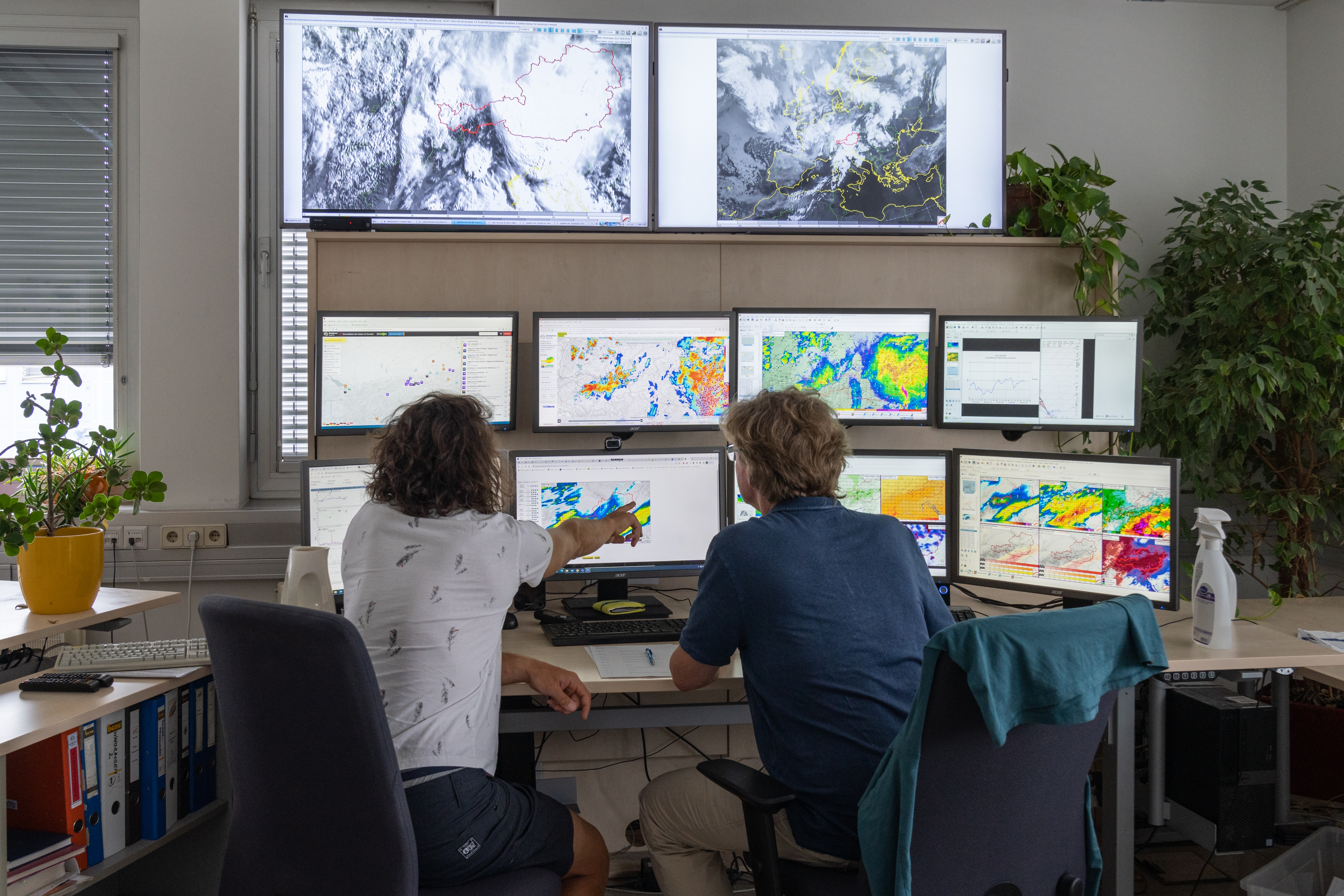
How are weather forecasts made?
Forecasting the weather as reliably as possible is a very complex process. Three essential steps are necessary:
Worldwide measurements: The basis for every forecast is the continuous recording of weather conditions around the world. This is done, for example, with measuring stations on land and on floating buoys as well as with weather balloons, radar and satellites.
The supercomputer: In large data centres, high-performance computers calculate how the weather will develop over the next few days.
Humans: Forecast models are constantly improving. Nevertheless, the experience of meteorologists is still very important in order to produce the most accurate forecast possible for a particular region.
Does GeoSphere Austria use their own weather models?
Yes, GeoSphere Austria’s high-performance computer runs the following regional forecast models in operational mode in order to calculate forecasts and warnings in different forecast periods with the smallest possible spatial resolution:
AROME: Horizontal resolution 2.5 km and 90 layers in the vertical. The model is recalculated every three hours and provides forecasts for the extended Alpine region for the next 60 hours.
AROME-RUC (Rapid Update Cycle): Enables weather forecasts for the next twelve hours for Austria and the surrounding area at a horizontal resolution of 1.2 km and 90 layers in the vertical. The model is recalculated every hour and the forecast is thus updated hourly.
Cooperation with national and international partners is of central importance for the development of GeoSphere Austria’s weather models. For example, we represent Austria at the European Centre for Medium-Range Weather Forecasts (ECMWF). The ECMWF operates the world’s most powerful global forecasting model. GeoSphere Austria uses ECMWF data for medium-term forecasts of up to ten days, monthly forecasts and as the basis for the above-mentioned high-resolution regional models.
Why does GeoSphere Austria have their own supercomputer?
The HPE Cray-XD2000 high-performance computer installed on the Hohe Warte in 2024 performs up to 870 billion computing operations per second. Areas of application include government crisis preparedness, forecasts and warnings in the event of extreme weather events, modelling of urban climate scenarios, air quality calculations and forecasts for renewable forms of energy. This high-performance computer makes it possible to predict weather phenomena even more precisely, particularly in the geographically challenging Alpine region, for which detailed weather forecasts are calculated several times a day.
Advisory services for civil protection
Through close coordination between disaster management, weather service, earthquake service, flood protection, avalanche warning service, geological service, provincial health directorate, torrent and avalanche control, etc., the Austrian Multi-Hazard Impact-based Advice Service (AMAS) helps to recognise more quickly, which regions could be most affected by impending extreme events and to be able to initiate appropriate protective measures. AMAS thus offers an optimal instrument to protect Austria even better against severe weather.
Impact-based Weather
Warnings
GeoSphere Austria’s warning system provides information to protect the population from potential weather hazards. Therefore, our weather warnings relate to the expected effects and possible dangers of the weather. This approach is referred to as impact-orientated. As a result, the numerical values of meteorological parameters such as wind speed, rainfall or snowfall are not the sole focus. Instead, factors that amplify or mitigate the effects of the weather situation are also taken into account and evaluated, such as the time of year and time of day, the foliage of the trees and a region’s previous exposure. In addition, recommendations are given in order to minimise or prevent as far as possible the damage to people, property and possessions caused by the expected warning situation.
You can find the latest weather warnings online. Customised warning and advisory services are also provided for state crisis and disaster management and for emergency organisations.
Risk Lab
Not only in the field of weather, but also in those of climate, geology and geophysics, it is important to go beyond the isolated understanding of physical processes in the individual disciplines. At GeoSphere Austria, the management of natural hazards and the assessment of risks are analysed in an interdisciplinary and transdisciplinary manner as part of the Risk Lab. The Risk Lab develops risk-relevant applications in the specialist areas of GeoSphere Austria, focussing on all relevant natural hazards. In particular, the Risk Lab is committed to the transfer of knowledge into concrete application and operationalisation. This includes impact-based weather warnings as well as climate risk analyses. Through this work, we are improving our understanding of risks and their effects. The overarching goal is to reduce the risk of disasters and improve adaptation to climate change in Austria.