Gravitational mass movements
Landslides, rockfalls, rockslides and rock avalanches can cause major damage to buildings and infrastructure. As a result, they endanger people’s living space and economic existence.
Natural hazard processes caused by gravity, such as landslides or rockfalls, result in considerable economic, social and ecological damage in Austria every year. This is primarily due to natural geological and geomorphological factors as well as extreme weather events. However, the intensive human use of potentially endangered areas and climate change increase vulnerability to these processes. Strengthening social resilience through hazard prevention approaches is therefore essential. Hazard information maps, protective structures and measures to stabilize slopes require good data and broad expertise on geological conditions, hazard processes and possible hazard scenarios.
This general term refers to the movement of rock or soil down slopes under the force of gravity. Based on this definition, further subdivisions are made according to the mechanisms and kinematics (fall, topple, slide, spread, flow), the material composition, the speed, the volume, the geometry and the depth of a mass movement. Ultimately, common terms derived from this include earth slide, rockslide, rockfall, rapid landslide and debris flow, to name just a few. Gravitational mass movements can be triggered by meteorological phenomena such as heavy precipitation, freeze-thaw cycles, slow erosion and weathering processes or even earthquakes.
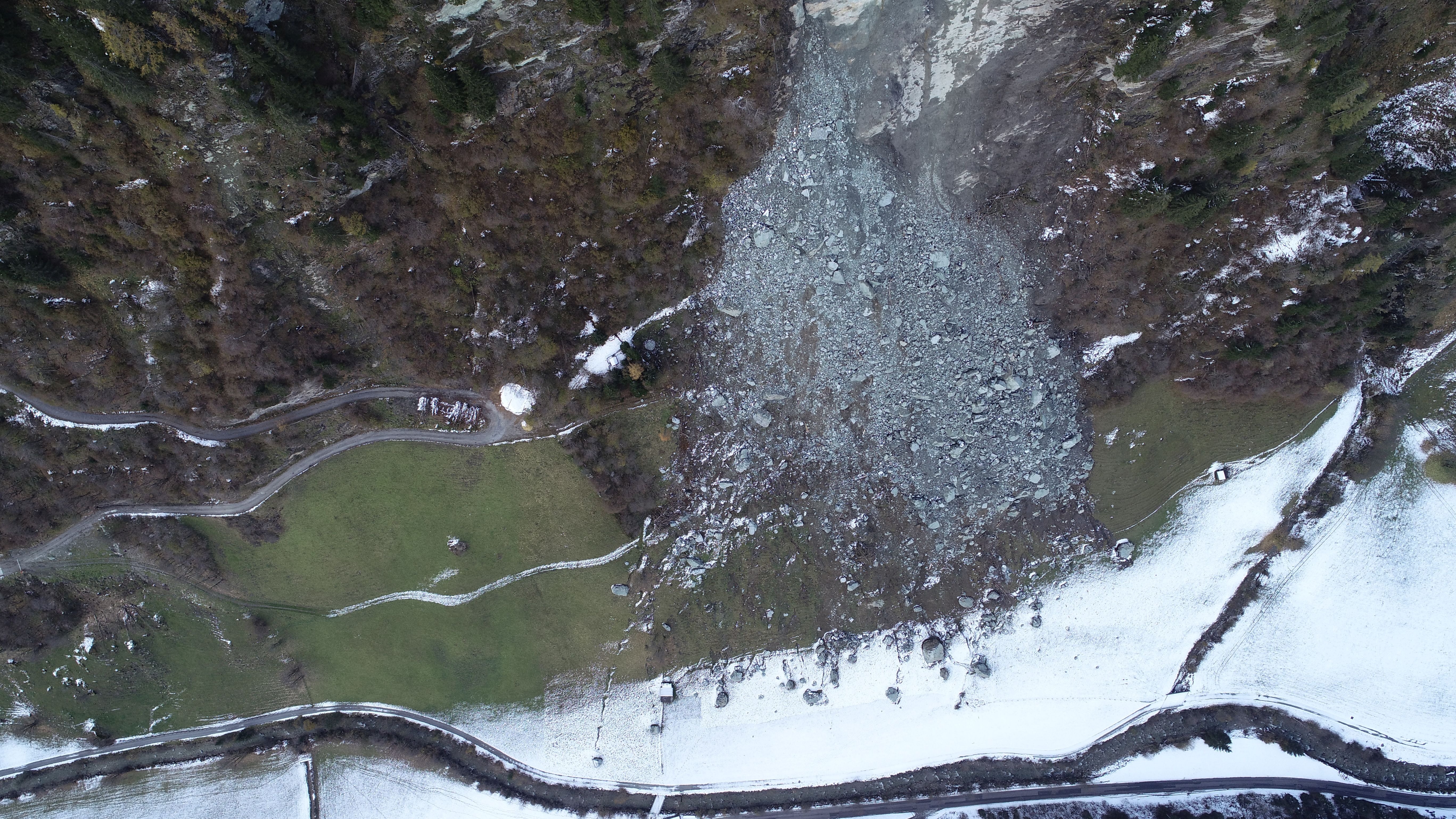
Rockfall in Hüttschlag/Hohe Tauern (Salzburg). © GeoSphere Austria/Koçiu.
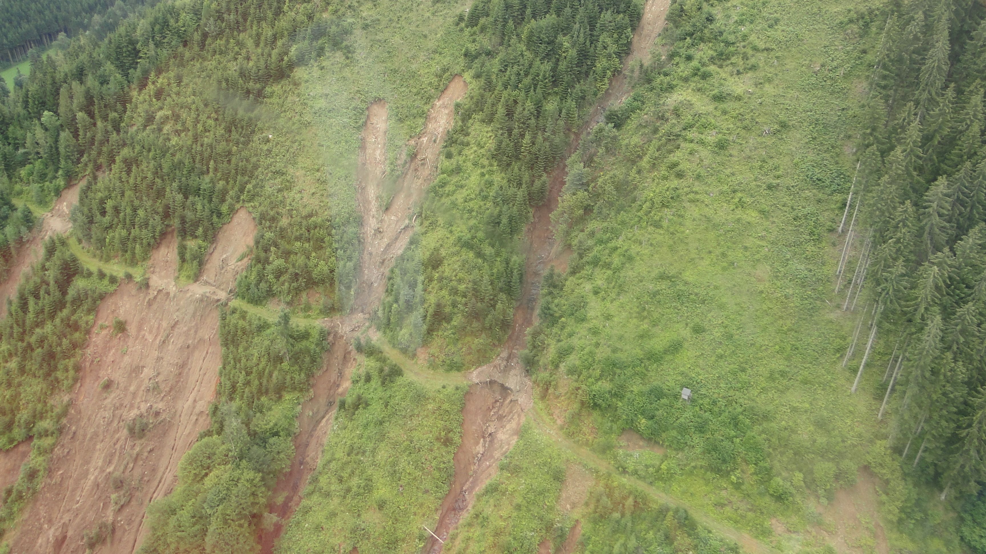
Debris flow on a steep slope. © GeoSphere Austria/Koçiu.
GeoSphere Austria provides important datasets for spatial planning and hazard prevention objectives. This relies on the recording of gravitational mass movements as part of event-related documentation, for example in the case of regional disaster events, as well as the collection of basic data as part of the systematic geological survey. In addition, an extensive evaluation of external data sources is included. Engineering geological mapping as well as airborne and ground-based geophysical measurements are used as exploration methods in the field. These are supplemented by remote sensing using aerial photographs, digital terrain models, drone and satellite data. In some cases, various long-term measuring devices are installed in selected areas in order to better understand natural processes. This improves the assessment of potential hazards and enables well-founded preventive measures to be taken with regard to the potential impact of gravitational mass movements on critical infrastructure, such as transport routes and supply lines. Satellite-based recording and analysis of the terrain surface in combination with regional weather forecast models is becoming increasingly important. There is still a great need for research in this area in order to create the basis for the development and implementation of early warning systems.
GeoSphere Austria currently has the most comprehensive, Austria-wide database of gravitational natural hazards, which is important for the most objective spatial planning and hazard prevention aspects possible. This documentation in maps, data and reports can be easily accessed online by the general public via web services and data portals. In the event of gravitational mass movements, decision-makers in particular can benefit from the specialized expertise as well as from technical measurement and monitoring systems hosted by GeoSphere Austria.
The consistent research in this area at GeoSphere Austria, regarding potential climate change impact, is leading to a constant expansion and improvement of the existing database, thus providing the basis for the most objective possible assessment of the existing and future hazard situation.