GeoSphere Maps
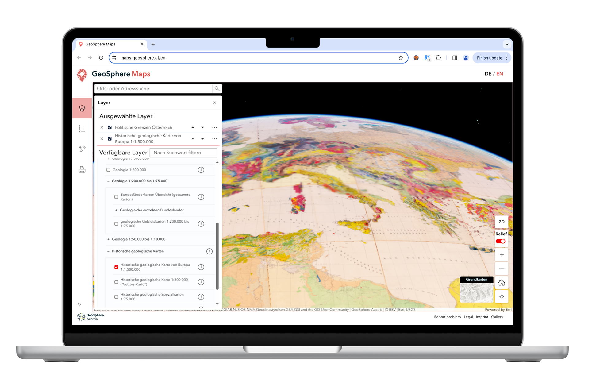
The GeoSphere Maps web application offers an interactive, map-based platform for geoscientific topics across the Austrian territory.
The user-friendly, bilingual web application allows for the visualisation of various geodata at a scale of up to approximately 1:10,000. In addition to selecting the map view, users can choose the map background and thematic layers. The displayed content is linked to further resources on our data and library platforms, thereby expanding the range of information available. Furthermore, users can add points, lines, and areas and export the map view as a PDF file.
Geosphere Maps- New version- Mukcup.png
Screenshot of GeoSphere Maps (release 1.2) showing the new 3D functionality. © GeoSphere Austria/Steffal.