Geoscientific data and models form the basis for decisions relating to spatial planning and settlement development, the sustainable use of raw materials and drinking water resources, geothermal resources, underground storage and the prevention of geogenic natural hazards. Society benefits from fact-based decisions and risk-conscious planning by political decision-makers.
State Survey
A central task of GeoSphere Austria is the national geological and geophysical survey, as set out in Section 4(3) of the GSA Act. This involves systematically recording, analysing, documenting and presenting the geological and geophysical conditions in Austria, including aspects such as geothermal energy, raw materials, groundwater, mass movements and near-surface subsurface exploration (e.g. for archaeological applications).
Our research relies on cutting-edge science and technology, contributing to a comprehensive understanding of the structures and processes on and beneath the Earth´s surface, down to its core. This forms the basis for new scientific findings and practical solutions to various socially relevant issues, including infrastructure projects, spatial planning, archaeology, natural hazard prevention, and the sustainable use of raw materials and other natural resources. The continuous updating and expansion of our database ensures that society can respond flexibly and promptly to current challenges such as climate change and technological developments. The survey therefore plays a key role in addressing complex social issues and improving quality of life and resilience in Austria.
state_survey_exposure_dating.jpg
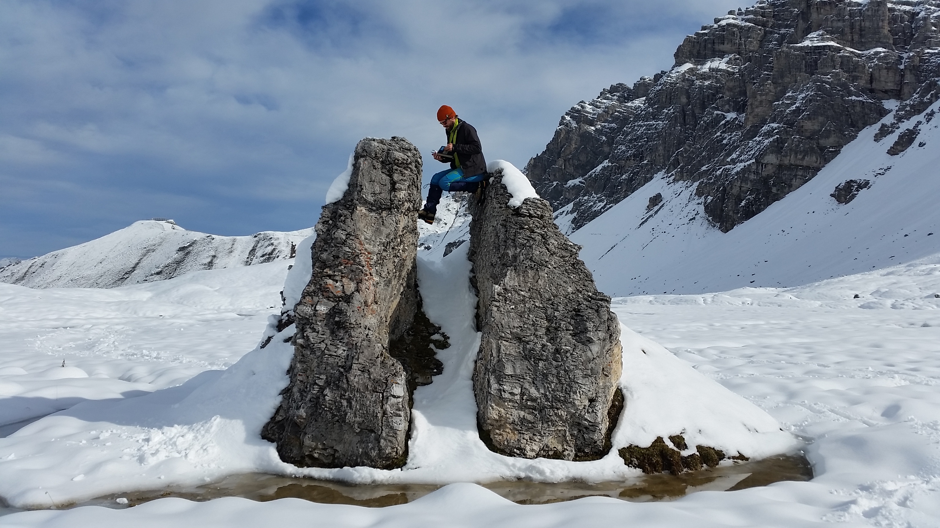
Sampling for exposure dating of a block on a moraine wall (Senders Valley, Stubai Alps, Tyrol) in the course of the geological survey. © GeoSphere Austria/Reitner.
Information from the fields of geology, geophysics, geochemistry, palaeontology, hydrogeology, engineering geology, and raw material geology contributes to the national survey at GeoSphere Austria. Our experts rely on scientifically sound methods when collecting, analysing and evaluating data, placing particular emphasis on quality assurance, traceability and established standards.
Geological map
Geological maps and profile sections depict the spatial distribution and age of various rock types and geological structures, such as faults, folds and fault lines, on the Earth´s surface. Available at various regional and supra-regional scales, they provide a spatial understanding of the subsurface. In addition, various geophysical parameters of the subsurface, such as electrical resistivity, magnetic properties and radiometric properties, can be incorporated into geological and applied geoscientific maps. Geological maps usually come with an explanatory text.
We use a variety of aerial and satellite-based remote sensing techniques to collect large-scale radiometric, gravimetric, and geomagnetic data. Radar interferometry enables the detection of vertical movements of the Earth´s surface using satellite data. This technique allows analysing ground subsidence, for instance, or to observe the activity of mass movements or rock glaciers. For small-scale issues, e.g. on a hectare-to-kilometre scale, we employ a variety of unmanned aerial vehicles (i.e. drones) with various sensors for radiometry. Our available equipment includes geoelectrics and electromagnetics, photogrammetry, LiDAR (light-based object recognition and distance measurement), infrared imaging, and multispectral analysis.
Due to the wide range of topics covered, data collection can be carried out in various ways. Examples include one-off measurement campaigns, regular repeated measurements (such as measuring the Earth´s magnetic field every 30 years), targeted inspections (such as quarry mapping, gallery inspections and sampling) and extensive recordings of geological conditions during field mapping.

Data recording during geological field work in Döllach (Styria). © GeoSphere Austria.
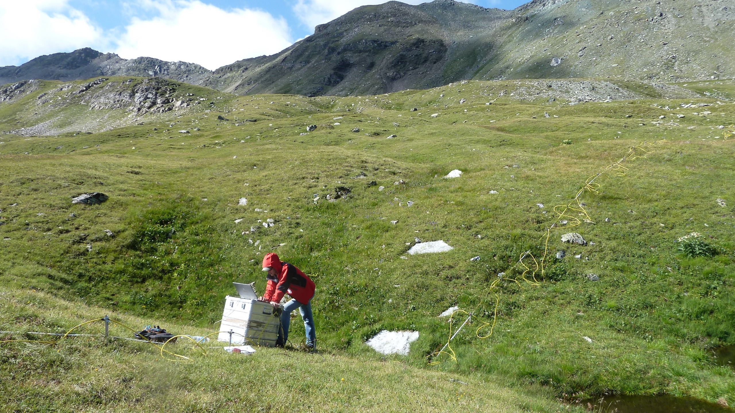
Geoelectrical measurement in the vicinity of the Glockner High Alpine Road (near Mittertörl, Salzburg). © GeoSphere Austria.
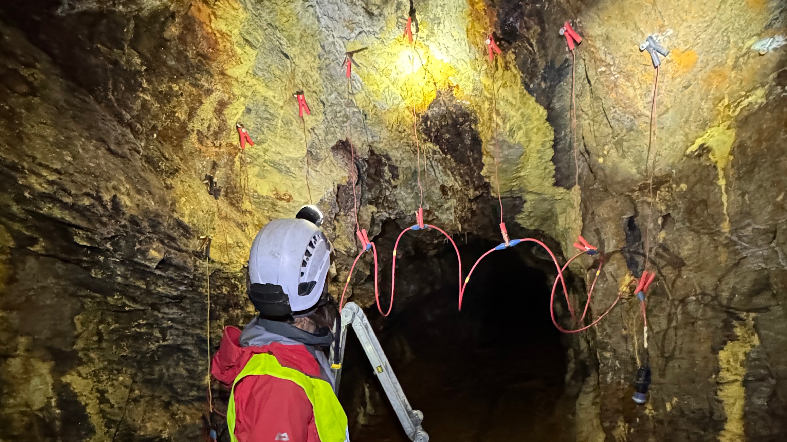
Geoelectric profile across an ore vein in the Imhofstollen (Gastein Valley, Salzburg). © GeoSphere Austria/Högenauer.
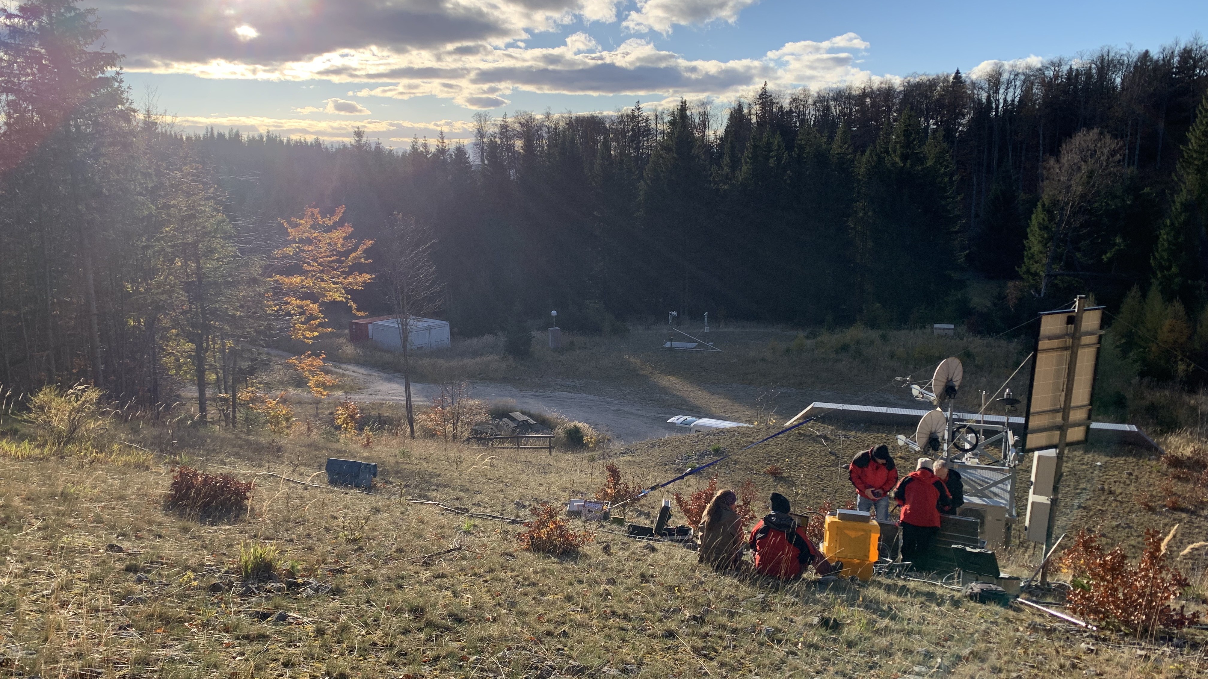
Construction of a geoelectric monitoring system in the vicinity of the Conrad Observatory in Lower Austria. © GeoSphere Austria/Högenauer.
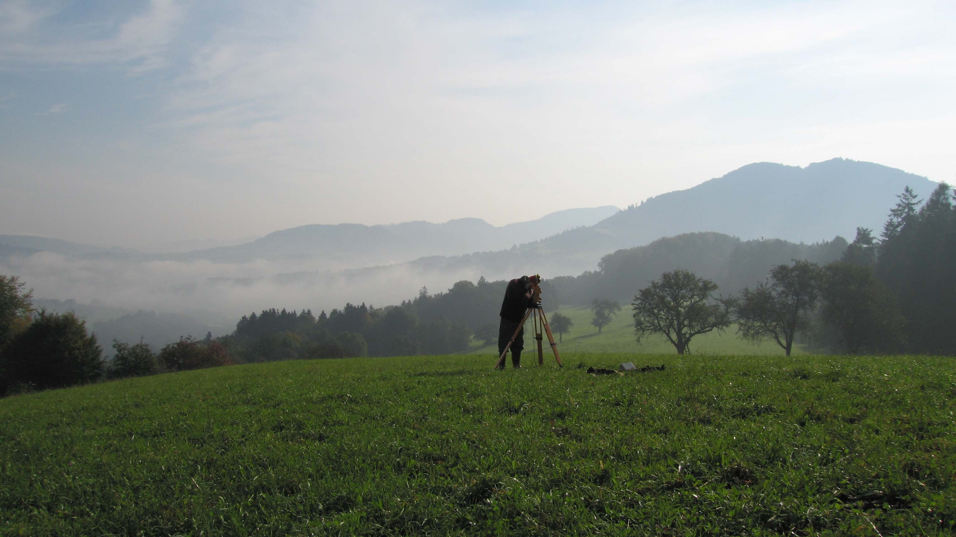
Measurement of the direction and strength of the local magnetic field in Scheibbs (Lower Austria) as part of the geomagnetic survey. © GeoSphere Austria.
Depending on the methodology used, the raw data acquired in the field (e.g. measurement data, recordings, images or samples) are subjected to various complex evaluation procedures (e.g. data quality control, filtering, inversion and modelling). Rock samples are prepared for further analysis to clarify issues such as the age of formation, the chemical and mineralogical composition, and the thermal and tectonic overprinting of minerals and rocks. To obtain correct and reliable results, these analyses are carried out according to current scientific standards, either in our own laboratories or in collaboration with national and international institutions and laboratories.
Geomagnetic mapping
Geomagnetic mapping records temporal and local variations in the Earth's magnetic field caused by geodynamic processes in the Earth's interior. Since the 19th century, measurement campaigns have been carried out in Austria every 30 years at over 300 locations. Additionally, annual measurements are conducted at select locations to update the national survey. Combined with continuous recordings at the Conrad Observatory, these measurements provide precise data on the direction and strength of the Earth's magnetic field in Austria, enabling precise geomagnetic maps and forecasts of future changes. This data is important for satellite navigation (GPS) and geophysical studies that analyse dynamic processes in the Earth's core.
Following the appropriate processing and careful examination of the results, this data forms the basis for creating high-quality, standardised products and services, such as maps, 3D models, publications and datasets. These are made available to the public via various portals and platforms.
- Text publications, such as reports and explanatory notes, can be accessed via our library system and are published by GeoSphere Austria.
- Data is archived and published on Tethys, GeoSphere Austria's CTS-certified research data repository.
- Map-based information on geoscientific topics is available via the GeoSphere Maps web application.
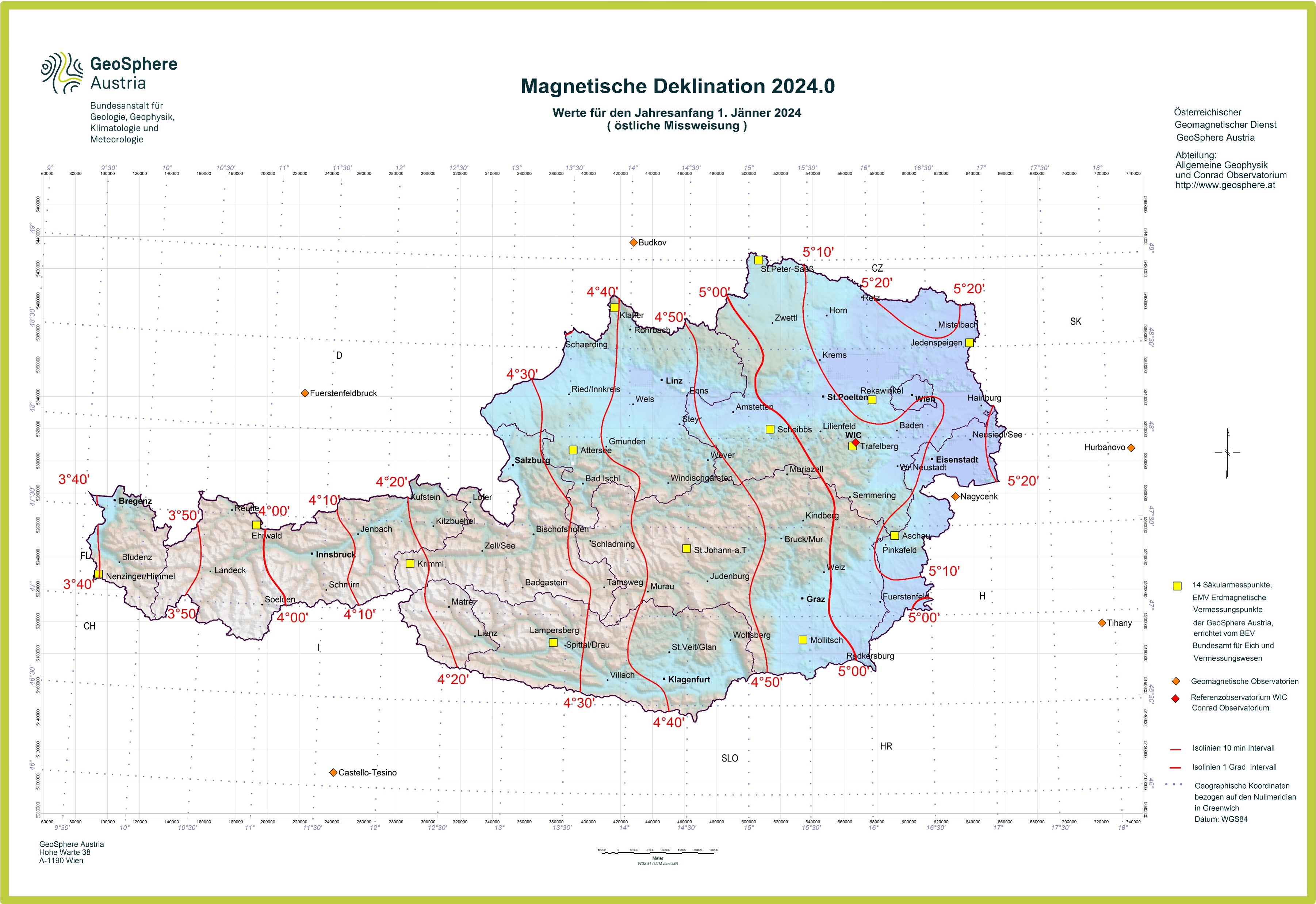
Current declination map for Austria. The map shows how much the direction of magnetic north deviates from that of geographic north at various locations. © GeoSphere Austria.
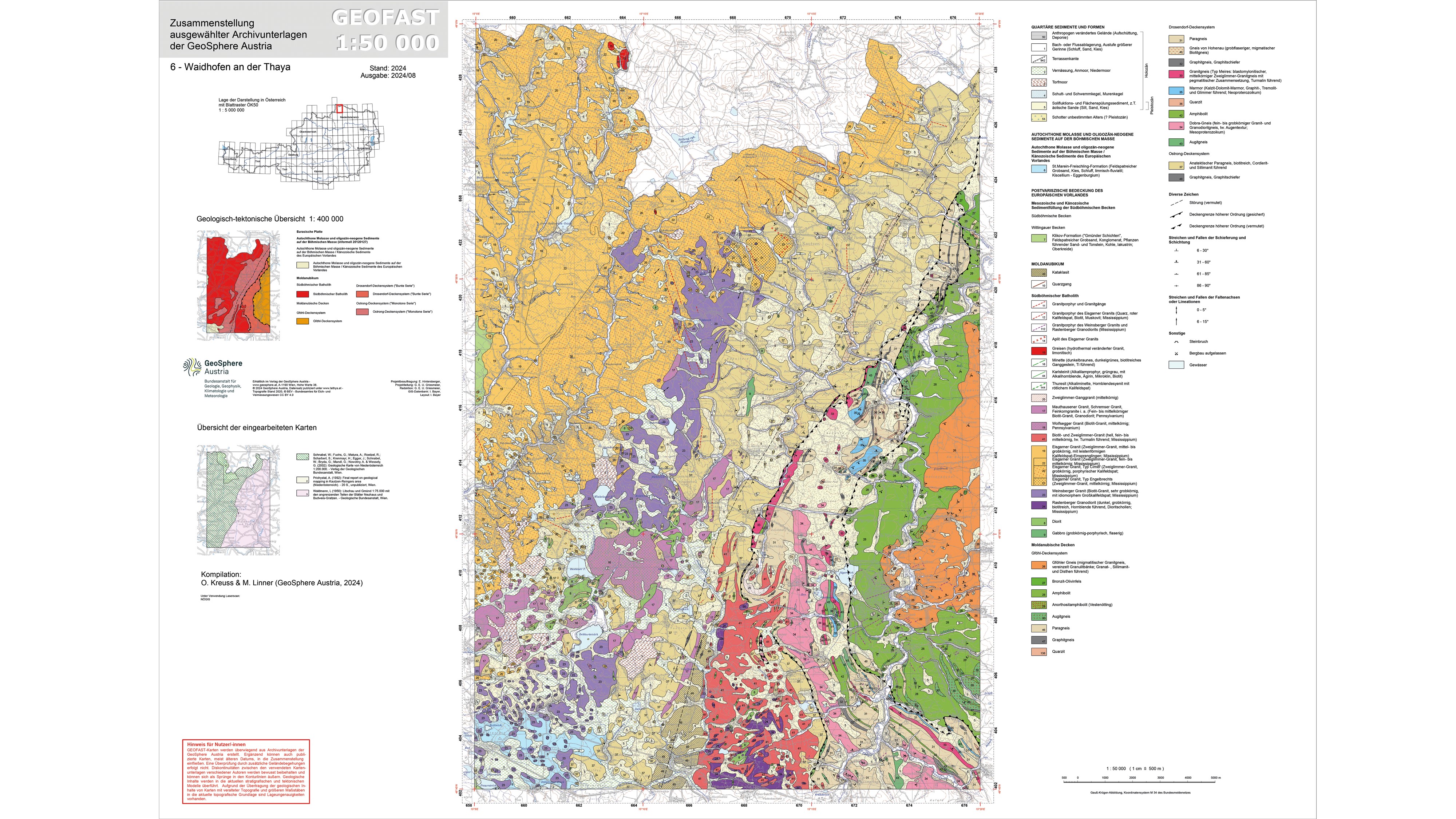
Geological map 1:50,000, sheet 70 Waidhofen an der Thaya (published in 2024 in the project GEOFAST). © GeoSphere Austria.
Our geoscientific data and models have a wide range of applications and provide a valuable foundation for scientific, economic and safety-related issues and decisions. Some interest groups and application examples are listed below.