Measurements
Measurements, i.e. the recording of the value of a physical parameter, are carried out throughout GeoSphere Austria’s entire field of activity, whether in the air, on the ground, directly in the subsurface in boreholes or even in laboratories.
In almost all of GeoSphere Austria’s specialist areas, the metrological recording of certain physical parameters represents a decisive basis for a better understanding of the current state of our geosphere, i.e. from the subsurface to the atmosphere. Measurements are conducted wherever a specific issue arises in a particular subject area and sufficient data cannot be generated from a permanently installed measurement network or obtained from an existing database. Measurement results only ever provide a snapshot of the current situation, from which in an ideal case the past can be reconstructed and predictions about the future state of our geosphere can be made.
The range of methods and applications for measurements is as diverse as GeoSphere Austria’s entire field of activity. In the field of environmental meteorology, for example, mobile stations and ground-based remote sensing methods are used to record the vertical structure of the atmosphere near the ground. The results of these measurements are used as input for the assessment of pollutant dispersion and immission modelling, but also as a planning basis for larger projects such as wind farms. In the fields of engineering, raw materials and hydrogeology, geophysical measurement methods as well as geochemical and mineralogical laboratory analyses are used in order to contribute to hazard prevention as well as supply security of drinking water and mineral raw materials. The Geoenergy department uses groundwater measuring points and geothermal probes to record the temperature and thermal conductivity of the subsurface and derive the potential for near-surface geothermal energy. By analysing fossils, palaeontology and biostratigraphy determine the relative temporal classification of rock strata and provide information about the prevailing climatic conditions of past times. The characterisation of magnetic minerals in rocks and sediments enables the creation of models of the global iron cycle and of the variations and structure of the Earth’s magnetic field on historical and geological time scales.
These are just a few examples of the applications of event-related measurements, which can also be realised at relatively short notice if necessary. In addition, further development in the area of data acquisition, data processing and visualisation as well as the consistent implementation of new technologies such as drone-supported measurement data acquisition or machine learning algorithms will contribute to the continuous improvement of the quality and, in a broader sense, the informative value of the generated data.
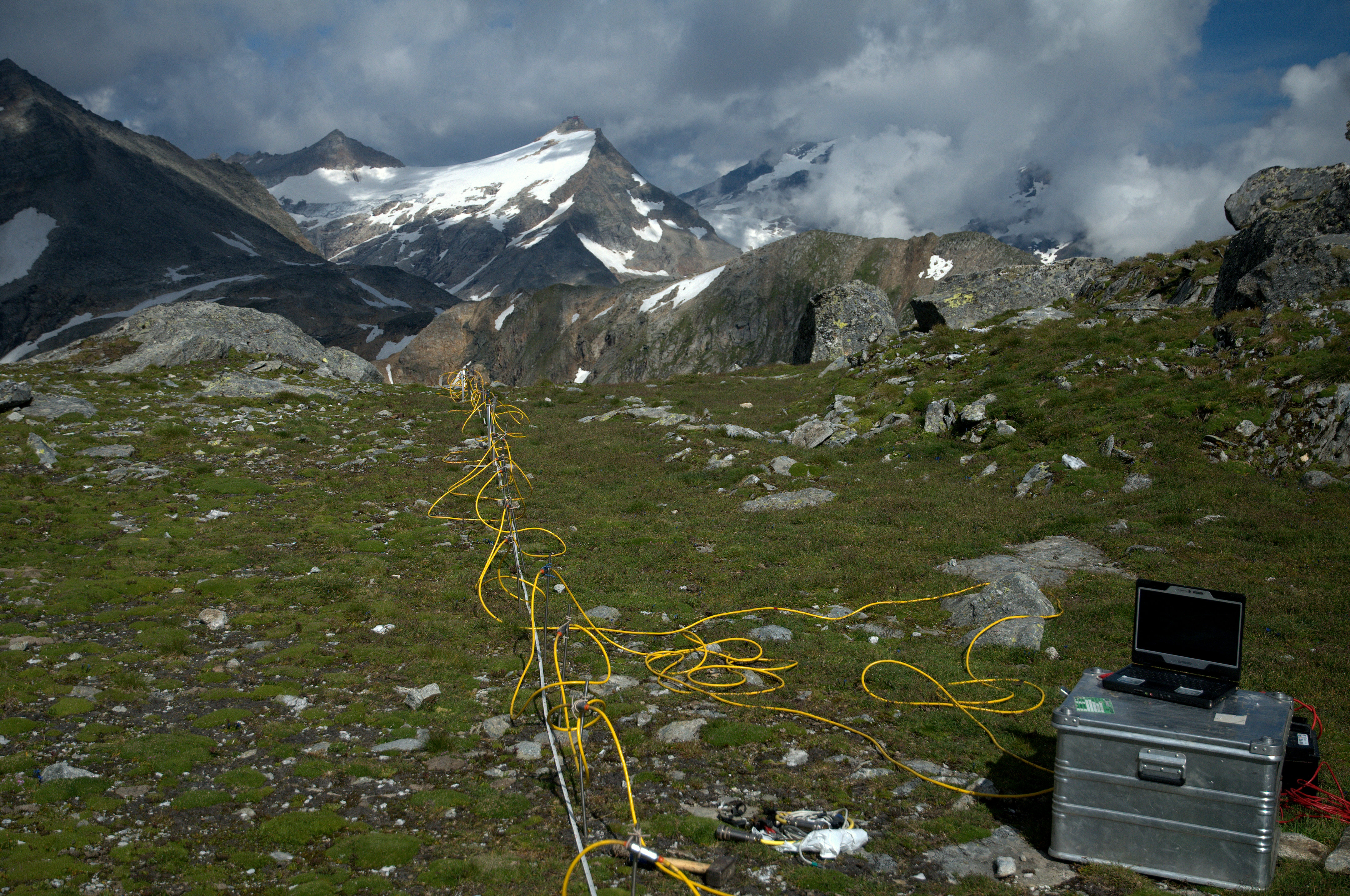
Electrical_resistiviy_Moelltal.jpg
Electrical resistivity survey at the Mölltal Glacier (Carinthia) in August 2012 © GeoSphere Austria.
The data and findings obtained are documented in maps, reports and publications and are subsequently made available to public institutions such as local authorities, government agencies as well as water and energy suppliers. On the other hand, commercially active companies, e.g. technical offices, civil engineers, plant engineers and planning offices and, last but not least, universities, project applicants and researchers at national and international level are also among the beneficiaries of an improved data situation. In summary, the social and economic relevance is primarily reflected in the fact that decision-makers from politics, business and science are supported in their planning and process development by the provision of a high quality and constantly improving knowledge base. With its broad portfolio of different measurements, GeoSphere Austria makes a relevant contribution to a deeper understanding of the processes in our geosphere.