While broadband stations are installed in seismically quiet areas to detect even the slightest tremors, strong-motion stations are used in urban areas to monitor stronger movements caused by earthquakes or human activity. These stations are less sensitive, but provide important data on the effects of vibrations on buildings and infrastructure. The correlation between the effects and the measured values of ground shaking enables a more precise assessment of the dynamic behaviour of the subsoil and a delineation of the requirements of future earthquake standards.
Measurement Networks
GeoSphere Austria provides precise measurement data for weather, climate and earthquakes.
GeoSphere Austria is the central provider of meteorological and seismological data in Austria. A closely meshed measurement network provides data that are essential for weather forecasts, climate research and earthquake monitoring. This data is not only used for research, but also for public safety and numerous economic applications. Thanks to state-of-the-art technologies and strict data controls, GeoSphere Austria provides reliable information that is immediately accessible to the public, authorities and companies. The precise collection and verification of data is crucial in order to recognise risks at an early stage and respond appropriately.
Suntracker_Sonnblick.jpg
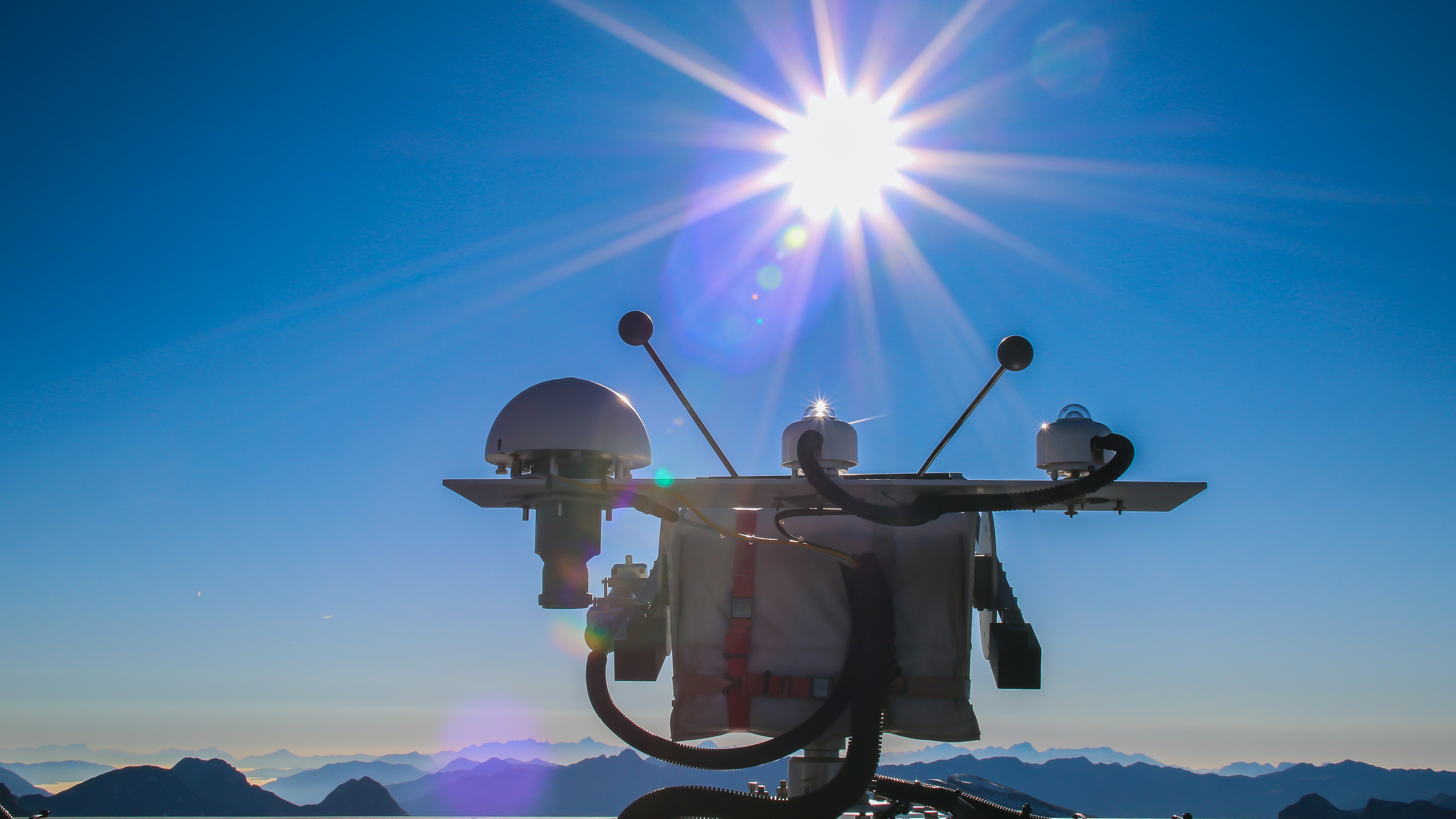
High-precision radiation measurement at the Sonnblick Observatory at 3,106 m. © GeoSphere Austria.
GeoSphere Austria’s meteorological monitoring network meets the international quality standards of the World Meteorological Organization (WMO) and forms the backbone for weather forecasts, climate products and climate research. With around 280 weather stations covering all climate regions and altitude levels in Austria, it ensures that precise weather data are available in real time. These data are not only used for internal purposes, but is also transmitted to energy suppliers, transport companies, emergency services and international organisations.
The majority of the stations consist of semi-automatic weather stations, which record basic weather elements such as temperature, humidity, precipitation and wind speed. These measured values are transmitted to the headquarter in Vienna every five to ten minutes, where they are checked for completeness and plausibility. The verified data then flow into databases and are available for weather forecasts, climate studies and economic applications.
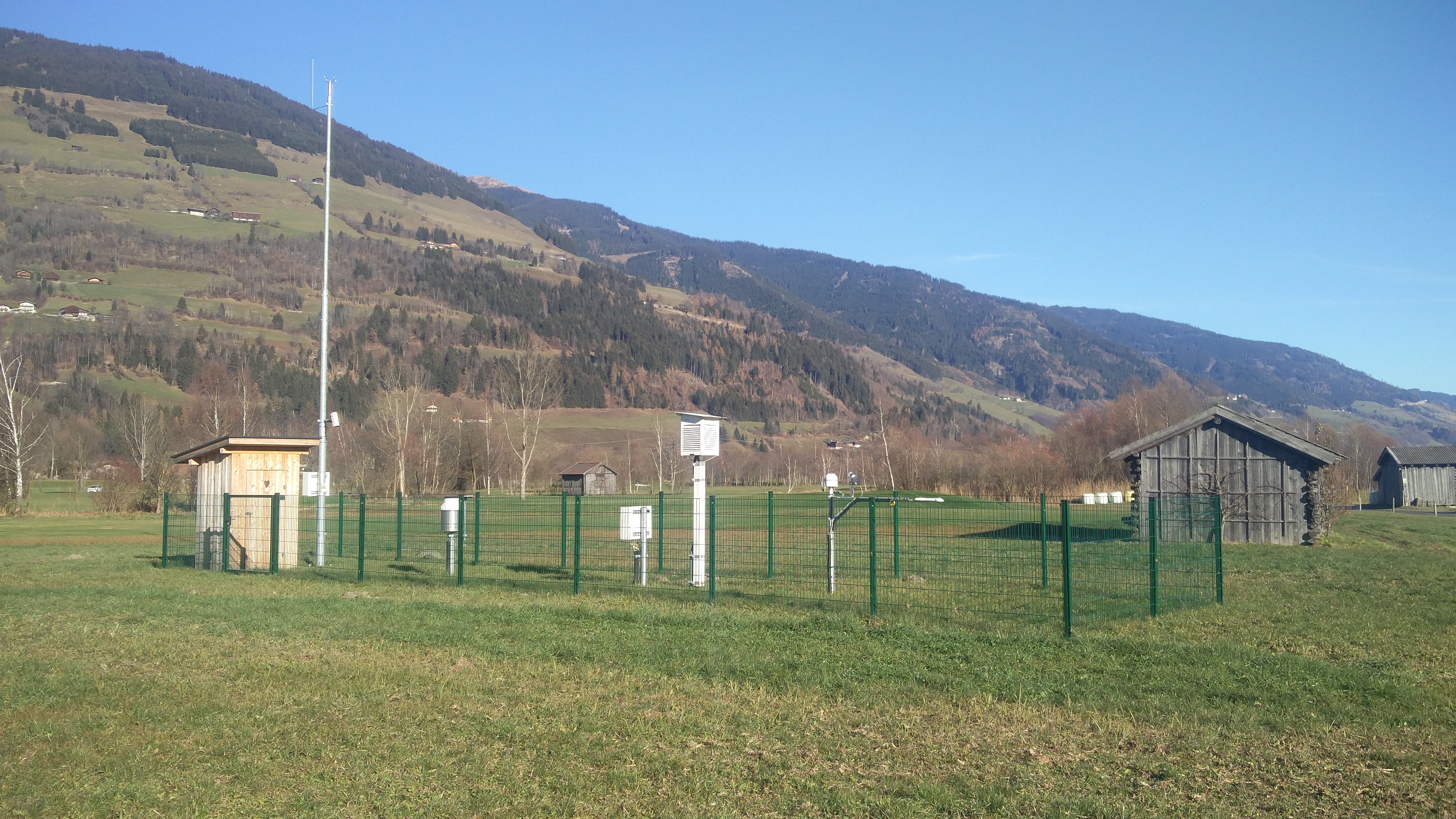
Semi-automatic weather stations (TAWES) in Mittersill (Salzburg). © GeoSphere Austria.
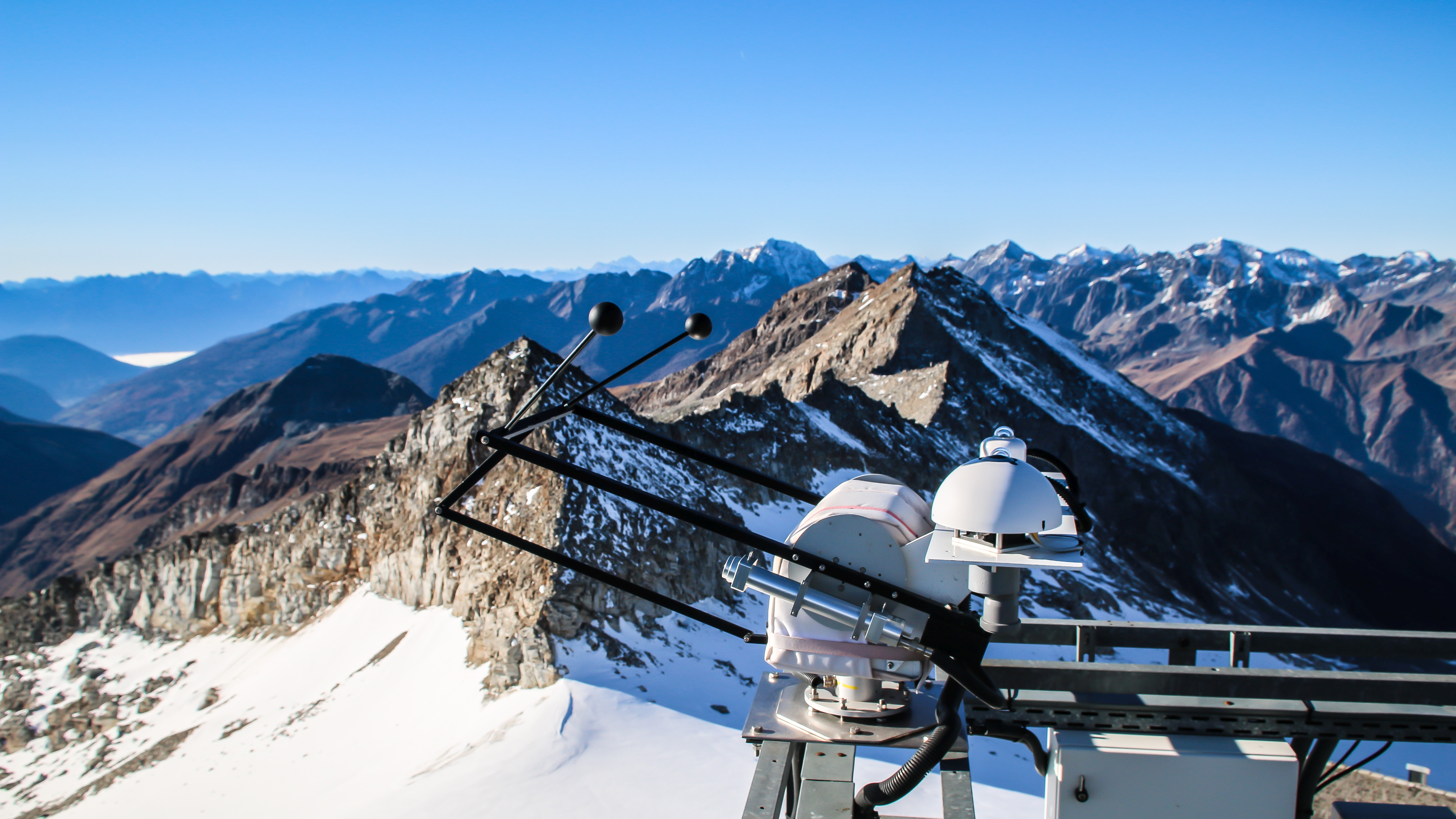
Measurements using a sun tracker. Bottom left: direct solar radiation, left: Long-wave radiation (shaded), centre: short-wave radiation ‘global radiation’, right: short-wave radiation shaded ‘sky radiation’. © GeoSphere Austria.
Trained supervisors at around 65 stations carry out additional manual observations in order to record information such as cloud cover, visibility and precipitation type. In addition, GeoSphere Austria operates 50 fully automated weather stations together with Austro Control, Austria’s air traffic management provider. These stations are equipped with special sensors for visibility and cloud conditions and provide important data for aviation meteorology, enabling safe and efficient flight monitoring.
Mobile measuring stations are used for special scientific projects or expertise. These make it possible to create precise weather records in smaller geographical areas or for specific periods. For example, air pressure measurements are taken in road tunnels in order to dimension and adjust the ventilation accordingly.
Overall, GeoSphere Austria’s meteorological measurement network is an indispensable part of Austria’s infrastructure. It not only provides the basic data for weather forecasts and climate modelling, but also for many other applications that affect the daily lives and safety of the population. From agriculture and the energy industry to emergency organisations – everyone benefits from the precise and comprehensive weather data that is available in real time.
In addition to the collection of data, data quality plays a central role at GeoSphere Austria. Every measurement in the meteorological monitoring network is checked automatically and manually to identify and exclude sources of error. This multi-stage control is particularly important for applications where the accuracy of the data is crucial, for example in climate research. Incorrect measurements are identified and corrected or, in case of doubt, deleted.
The digitisation of historical climate records is another key aspect of GeoSphere Austria’s work. Much of these data are unique and contribute significantly to the understanding of long-term climatic developments. Long and high-quality data series are invaluable for climate research in particular. Although many records were lost during the Second World War, GeoSphere Austria was able to preserve a valuable collection of historical data, which is continuously being digitised and processed for future climate science studies.
In addition to the meteorological monitoring network, GeoSphere Austria also operates the only permanent seismic monitoring network in Austria. This comprises over 30 broadband stations, which record even the smallest tremors, as well as over 30 strong-motion stations installed in urban areas. They mainly measure ground motion caused by earthquakes and industrial activities such as mining (blasting). However, other signals such as rockfalls, explosions, sonic booms (meteors, aeroplanes), nuclear weapons tests, induced tremors caused by man-made interventions or even vibrations at concerts are also recorded.
The data from the seismic monitoring network are of central importance for the assessment of earthquake hazards and the creation of hazard maps, which in turn are incorporated into building regulations. Insurance companies also use these data to calculate risks and determine premiums. In the event of an earthquake, the data are analysed in real time to determine rapidly the magnitude and location of the quake. This enables the estimation whether the recorded tremors are within the design limits for buildings, which areas are most affected, and whether damage is to be expected.
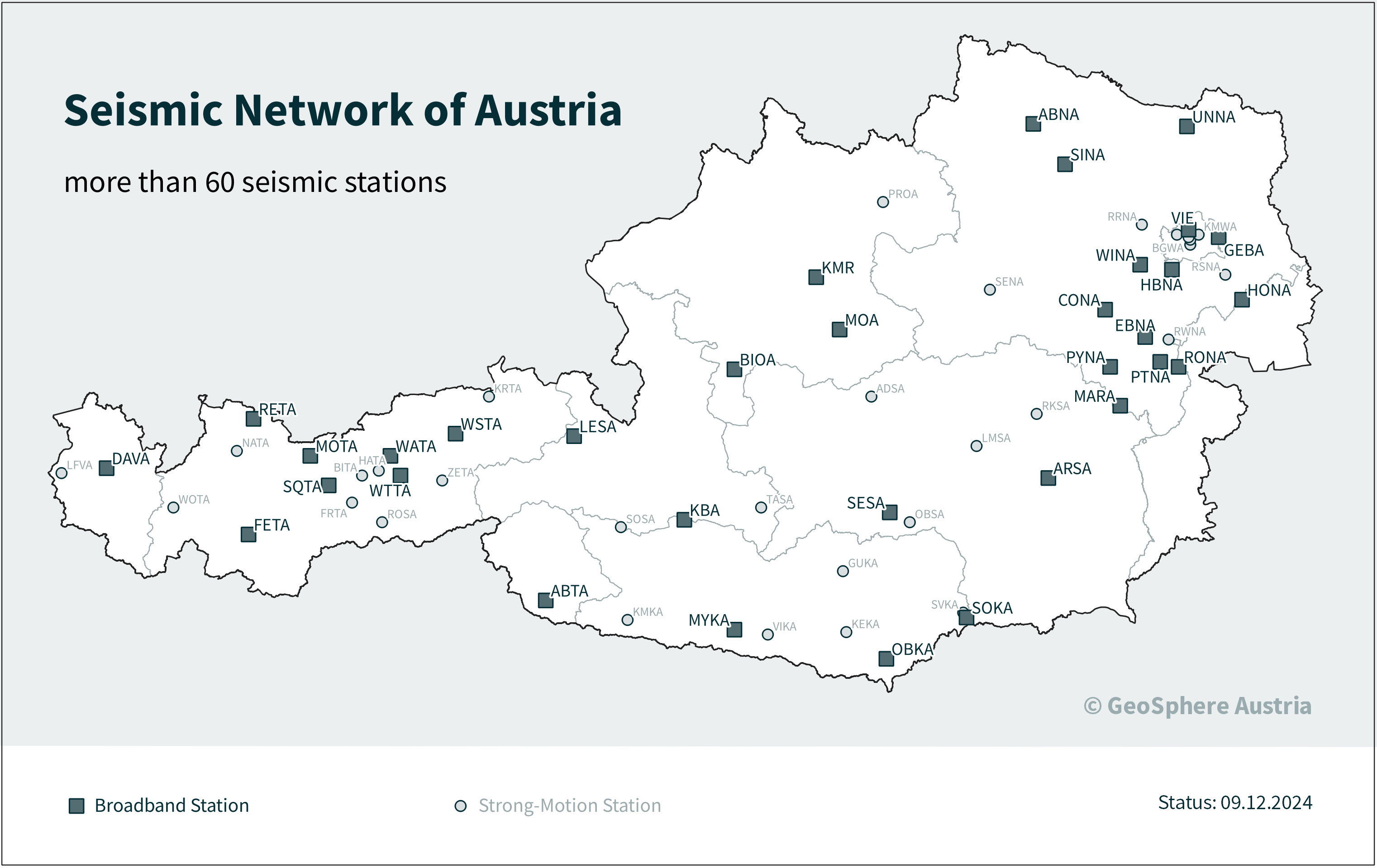
Seismic network_eng.png
GeoSphere Austria operates 60 seismic stations throughout Austria. © GeoSphere Austria/Hausmann.
GeoSphere Austria has many international connections and exchanges seismic data with partners in Europe and around the globe in order to increase the accuracy and reliability of our earthquake monitoring. As a leading organisation in the development of international standards for the exchange and evaluation of seismological data, GeoSphere Austria promotes the exchange of knowledge and technological innovation. This close co-operation has made it possible to set up additional seismic stations and improve monitoring in border regions.
Whether meteorological data for weather forecasts and climate research or seismic data for earthquake monitoring – GeoSphere Austria ensures that reliable and up-to-date data is quickly available for a wide range of applications. This data helps to identify natural hazards at an early stage, minimise risks and ensure public safety. The precise monitoring and quality control of the monitoring networks ensure that science, industry and the public have access to high-quality information at any times. GeoSphere Austria keeps up to date with the latest technological developments and works closely with international partners to optimise further data accuracy and availability.